Big Island Hawaii's "Smart Growth" Redevelopment Plans
11,192 View

- Publish Date:
- September 6, 2024
- Category:
- Real Estate
- Video License
- Standard License
- Imported From:
- Youtube
Welcome truth seekers and independent investigators. Join me for my next premiere, with a live chat, Saturday at 10am Hawai'ian, 1pm Pacific, 2pm Mountain, 3pm Central, and 4pm Eastern!
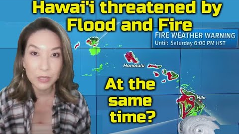
In this premiere, we cover the recent Hurricane Hone, and how there were BOTH flood and fire warnings at the same time, with windward sides getting up to 2 feet of rain while leeward sides were allegedly under dry conditions of low relative humidity, which is unlikely in such close proximity to a hurricane.
We also cover the redevelopment plans on Big Island, including the newly updated County of Hawai'i General Plan for 2045, the Envision Downtown Hilo 2025 plan, the Kona Community Development Plan, the Puna Community Development Plan, the State of Hawai'i Strategic Plan for Transit Oriented Development (TOD), and a few others.
These plans also now include fire and flood hazard maps, which match up with disaster zones, such as the Lahaina fire burn zone matching up with the West Maui TOD Corridor plan, fires on Kauai matching the Kauai TOD redevelopment zones like Hanapepe, the Paradise, Oroville, and Chico California fires clearing land for the North Valley Rail, and the Ruidoso New Mexico fires, which even had planning meetings DURING the fire. Hilo is shown to be most vulnerable to flood, while Kona is the most vulnerable to fire.
*Sound the Alarm book available now!*
https://themauibook.com/
*FOLLOW ALONG WITH OUR INVESTIGATIONS USING THE LINKS BELOW!*
Hawaii County under TS warning, Hone could become hurricane Sunday
https://youtu.be/maGxTSDV2R4?si=8-TY-AKKPGmXEaDz
Hurricane Hone prompts extension of Flash Flood Warning on Big Island
https://youtu.be/Jdv_hYA0oKM?si=7WCKZpMq-mvMEerC
Tropical Storm Hone moving away from Hawaii after dumping more than 2 feet of rain on Big Island
https://www.foxweather.com/weather-news/tracking-hurricane-hone-hawaii-impacts
Big Island family hit hard by Hone picking up the pieces
https://youtu.be/Ik3yj5E0eTk?si=L4EHgvw2S2Fe1R1T
Is Honolulu the next land grab after Maui?
https://youtu.be/MTb88U_ui8U?si=2xGxW0IXvzVt96CE
Kauai's 10-minute city plans!
https://youtu.be/r09L_E-iWVM?si=WtEcxk974cZctKSU
County of Hawai‘i General Plan 2045
https://www.planning.hawaiicounty.gov/home/showpublisheddocument/308136/638597487229830000
County of Hawai‘i Planning Department Calendar
https://www.planning.hawaiicounty.gov/about-us/planning-department-calendar/-curm-9/-cury-2024
State of Hawaii Strategic Plan for Transit-Oriented Development
https://files.hawaii.gov/dbedt/op/lud/TODStratPlan_Aug2018_Current.pdf
Hawaii Interagency Council for Transit Orientated Development TOD Project Status and Plans Report of Hawaii County
https://files.hawaii.gov/dbedt/op/lud/20181113_HawaiiTODProjUpdateRpt.pdf
Kona Community Development Plan
https://www.planning.hawaiicounty.gov/general-plan-community-planning/cdp/kona
Mapping Kona's Future
https://www.planning.hawaiicounty.gov/home/showpublisheddocument/301809/637205633777570000
Envision Downtown Hilo 2025
https://www.slideshare.net/slideshow/draft-envision-downtown-hilo-2025-5year-action-plan-update-3082871/3082871
*Please SUBSCRIBE to support this channel*
Some shirts still available:
https://justice-now-837067.square.site/s/shop
email:
[email protected]
#bigisland #bigislandhawaii #redevelopment #lahaina